Alright, mate, keen to wrap your head around drone mapping and dive into the world of buzzing technology? Well, you’ve landed in the sweet spot.
This guide’s gonna be your go-to, your Holy Grail, for soaking up all the goss on drone mapping.
Now, the realm of drone mapping and surveying is shifting faster than a sheepdog chasing a runaway sheep. So, when you’re starting out, it’s bloody important to get a good grip on the latest drone mapping tools and tricks.
In this yarn, we’re gonna unravel the mystery of drone mapping software. We’ll help you figure out which one’s your perfect match – like Tinder for tech, but less awkward. You’ll be getting a front-row seat to the nitty-gritty of how drone mapping does its thing and the wizardry that makes it happen.
Hold on tight, ’cause you’re in for a ride. We’ll spill the beans on the rad applications of drone mapping and even give you a sneak peek into what the future holds for this tech whirlwind. Spoiler alert: it’s making traditional aerial surveys look like a fax machine in the age of smartphones.
By the end of this guide, you’ll be the guru of drone mapping tech, ready to squeeze every drop of awesomeness out of it. So, grab a cuppa, kick back, and let’s turn you into a drone mapping maestro, my friend. Cheers to the future in the skies!
What is Drone Mapping?
Ever wondered what the heck drone mapping is? Well, hold onto your jandals because I’m about to spill the beans, Kiwi style.
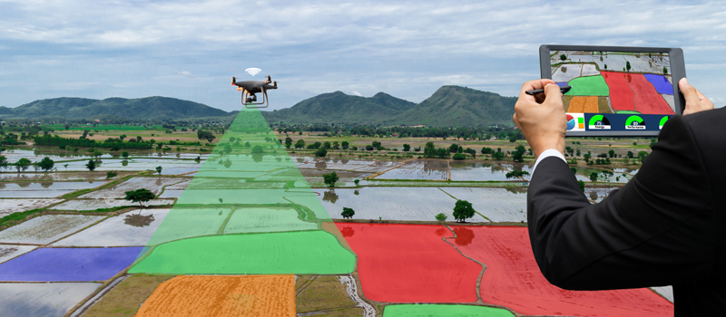
Drone mapping, mate, is like measuring with a twist – we’re talking measuring from photos. Picture this: drones taking a solo flight, snapping pics left, right, and center to cook up maps and models that look so real, you could almost smell the virtual grass.
Drones, those buzzing marvels, have done a U-turn on how we suss out our turf. Efficiency, speed, and accuracy – drone mapping has cranked up the volume in heaps of industries.
Now, let me give you the lowdown on this drone mapping shindig.
Imagine using unmanned aerial vehicles (UAVs) to snag airborne data and whip up maps, models, and other eye candy for a worksite. It’s like your drone becoming a photogrammetry rockstar – measuring from images like a pro.
In simple as, drone mapping is the art of sending your drone on autopilot missions, crafting 2D maps and 3D models like it’s on a mission from the mapping gods.
Drone mapping is a tech mashup, throwing in photogrammetry, LiDAR, SLAM lidar – it’s like a cocktail of high-tech wizardry, creating images and data that get everyone in surveying, agriculture, construction, and environmental monitoring doing the haka.
Photogrammetry is the MVP here – measuring from photos is its jam.
And, get this, for underwater mapping, drones dive in with dual-band sonar, grabbing data sets below the waves. It’s like they’re the James Bond of mapping, just without the tuxedo.
I know, it might sound a bit techy, but stick with me, mate.
Let’s kick off with why drone mapping is shooting up the ranks faster than a sheepdog chasing a frisbee – trust me, it’s worth the yarn. So, grab a cold one, and let’s dive into the world of drone mapping, Kiwi style. Cheers to mapping like a pro!
The Importance of Drone Mapping
Ever heard about the epic saga of drone mapping and why it’s the real MVP in the tech game? Well, grab a cuppa, ’cause I’m about to spill the tea Kiwi-style.
So, there’s this report, “The Economic Impact of Unmanned Aircraft Systems Integration in the United States,” by AUVSI – a bit of a mouthful, but it’s got the 411 on why chucking drones into the mix is the bee’s knees.
AUVSI’s research predicts that in the first three years of this drone dance, the US will be popping up over 70,000 new jobs, with a whopping $13.6 billion economic boost. And get this, it’s like planting a money tree – by 2025, we’re looking at over 100,000 jobs and an economic party worth $82 billion. That’s more zeros than I can count after a couple of cold ones!
How Does Drone Mapping Differ From Traditional Mapping Methods?
Now, to get why drone mapping is the hot potato, you gotta know how it’s the rebel in the mapping world, giving traditional methods a run for their money.
Why, you ask?
Well, picture this: drone mapping is like the Usain Bolt of mapping – it’s faster, serves up data so sharp it could cut a pavlova, and won’t break the bank.
Traditional mapping is like yesterday’s news, and drone mapping swoops in with high-res aerial data that’s more on point than your mate’s DIY BBQ skills. That precision? It’s a game-changer for making smart decisions and doing some top-notch planning.
And here’s the real kicker – no more manual data collection malarkey. Drones roll in, provide real-time data quicker than you can say “fish and chips,” and save us from drowning in paperwork like a soggy pav. Plus, they’re the daredevils of the sky, zipping to spots humans can’t touch with a 10-foot pole – think towering buildings, thick forests, or those dodgy disaster zones. Suddenly, the impossible becomes a walk in the park.
But wait, there’s more! No need for a hefty squad of surveyors or splurging on fancy gear. Drones are like the minimalists of the mapping world, doing more with less.
And the cherry on top? Safety first, bro! Drones dodge the need for folks to dance with danger, keeping everyone out of harm’s way and making workplace safety the real MVP.
Now, let’s dive deeper into the juicy bits – the nitty-gritty benefits of unleashing drone tech on the mapping scene. Stick around, and let’s uncover why mapping with drones is the real McCoy, my friend. Cheers to mapping made easy!
Additional Benefits of Using Drones for Surveying and Mapping
Ever heard how drone mapping is like the rockstar of the surveying world, shaking things up and turning the old ways on their head? Well, strap in, ’cause I’m about to spill the tea, Kiwi-style.
First off, drone mapping is the Usain Bolt of the mapping game – it’s quicker than a sheepdog chasing a runaway lamb, making traditional ground-based surveying look like a leisurely stroll in the park. Time’s money, right? And drones save us a boatload of both.
Accuracy, my friend, is the name of the game. Drones serve up high-res aerial shots and data that could spot a kiwi in a fruit bowl. It’s like having a mapping wizard in your pocket, combining info from ground-based sensors for a precision dance that traditional methods can only dream of.
Safety first, though! Drones do the risky business, so us surveyors can keep our feet on solid ground. No need to wrestle with hazardous spots or play Spider-Man climbing cliffs – safety is the real MVP.
Now, if you’ve got the green light and the right papers, these bad boys (unmanned aerial vehicles, or UAVs, if you’re feeling fancy) can pull double duty in security gigs. Private corporations, sports events, the local pub quiz – you name it, drones can keep an eye on it. They’re like the multitasking superheroes of the sky, especially handy during natural disasters for security and recovery missions.
Remote spots? No problem, bro! Drones swoop in like your trusty sidekick, mapping areas that used to be off-limits. They’re like the mapmakers of the impossible.
Data collection? Hold onto your jandals! 3D drone mapping slurps up data faster than a Kiwi crushes a pavlova at a summer barbecue. It’s a data feast that whips up detailed maps and models in the blink of an eye.
And those aerial shots? Drones are the Spielberg of the sky, snapping pics and videos that make your Instagram game look like a primary school art project. High-res images turn into 3D maps and models that are practically magic, with more uses than a Swiss Army knife.
Now, before we get too carried away, let’s talk about the elephant in the room – limitations. Every superhero has their kryptonite, and drones are no different. But don’t worry, we’ll tackle those quirks so you can navigate this tech landscape like a pro. Stick around, mate, and let’s dive into the highs and lows of drone mapping, Kiwi style. Cheers to mapping adventures!
Limitations of Drone Mapping
Now, let’s talk about the not-so-glamorous side of drone mapping, the little quirks that keep it from being the Superman of mapping technologies. But hey, no worries, we’ll navigate this like pros. Ready?
First up, the wallet hit – cost. Drone mapping tech can be a bit of a splurge, especially for the little guys. Smaller organizations might feel like they’re trying to fit a jigsaw puzzle piece into a game of Monopoly. Not ideal, but hey, we’ll figure it out.
Now, the techy stuff – it’s not all sunshine and rainbows. Drone mapping demands some specialized skills to rock that equipment. It’s like expecting your grandma to master the latest gaming console – not everyone’s cuppa tea. But fear not, my friend, there’s a lifeline. Take a spin with the Comprehensive Mapping Course via Drone U membership, and suddenly you’ll be the Jedi of the mapping galaxy.
Privacy and red tape – the fun police of drone mapping. It’s like playing a game of backyard cricket with your neighbors – everyone’s got their eyes on the ball. The FAA lays down the law, saying airspace is like a double-dipped ice cream cone – part yours, part public. But hey, have Southwest Airlines ever given you a bell when they zoom over your backyard? Nope, ’cause it’s like the highway of the sky. Still, some folks in the countryside might think you’re the eye in the sky, spying on them. Just reassure them you’re not auditioning for the next James Bond flick.
Now, weather playing the party pooper – classic Kiwi move. Drones aren’t fans of heavy rain or winds that could blow away your hat. So, they might sit out the party till the weather’s more chilled than a chilly bin at the beach.
Equipment limitations – like having a ute that can’t handle the farm run. Drones have their range and endurance limits, plus the hassle of finding spare parts and maintenance services. For massive mapping adventures, you might need a fixed-wing drone – the marathon runner of the drone world.
Now, we’ve laid it all out – the highs and lows of drone mapping. Ready to plunge into the nitty-gritty of how this wizardry actually works? Hold on to your jandals, mate – it’s about to get interesting!
How Drone Mapping Works?
So, you’ve dipped your toes into the drone mapping pond, but what’s the real deal behind the scenes? Let me break it down for you, Kiwi style, with a bit of cheekiness thrown in for good measure.
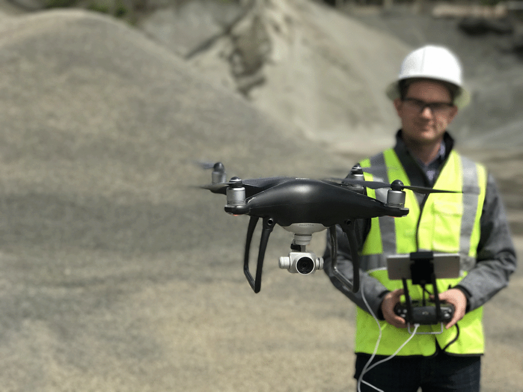
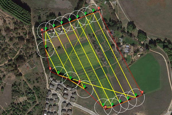
First off, mission planning – it’s like plotting a treasure hunt but with drones. You gotta pick the right flying mate, sort out the software dance, and choose a mapping solution that’s like the GPS for your drone adventures. Plus, you’ll need to sweet-talk the local and federal agencies for airspace thumbs up. Quick tip: with DJI drones, the usual go-to apps might be playing hard to get, so pilots are flexing their creative muscles with the Mavic 3 Enterprise and DJI Pilot 2.
Now, the nitty-gritty of flight plans – it’s the double grid hustle over your spot, a bit like mowing the lawn but way cooler. A 75/75 overlap and a camera tilt that’s got more angles than your grandma’s knitting – that’s the secret sauce for creating the goods.
Next up, capturing media – it’s the fun part. Pilots hit the autopilot button, and the drone does its thing, snapping pics and collecting data like a boss. The strategy here? Well, it depends on the goodies you want to whip up for your client. It’s like choosing toppings for your pizza – personal and a bit strategic.
Last but not least, processing the drone data – the grand finale. Fire up the specialized software, and voilà, turn that raw data into 2D maps or 3D models. It’s like turning your mum’s legendary roast into a gourmet dish – takes a bit of magic and the right tools. Then, sprinkle some insights on top and deliver the goods to the client.
Alright, high five! You’ve cracked the code on drone mapping. But hold onto your jandals, mate – we’re just scratching the surface of this tech wonderland. Ready to dive into the applications of drone technology? Spoiler alert: it’s like opening a bag of chips – you can’t stop at just one. Let’s keep this drone party rolling! Cheers to mapping adventures!
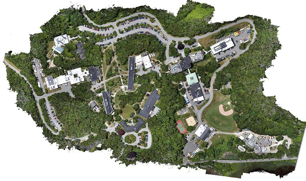
Applications of Drone Mapping
Let’s talk about the cool stuff – the real-life magic of drone mapping that’s shaking things up in more industries than a good ol’ Kiwi barbecue. Buckle up for the ride!
Agriculture drone mapping
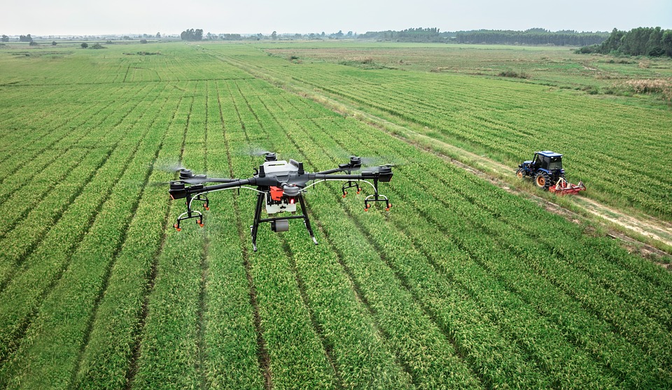
First on the list – Agriculture, the backbone of our good green land. The UN reckons our global crew will hit a whopping 9.7 billion by 2050. That’s a lot of mouths to feed, eh? Enter drones, the superheroes of the farming world. Picture this: monitoring crop health, sniffing out soil quirks, and planning the ultimate spa day for your crops with irrigation and fertilization programs. And here’s the kicker – indexing crops like a pro. Drones whip up detailed maps, making crop TLC a breeze.
Now, let’s zoom into the Southern United States, where rice and peanut farmers are facing a bit of a water trouble. The water tables are doing the limbo, and the distribution systems are feeling a bit wonky. Enter our trusty drones, armed with maps and “digital terrain models.” They’re like the Sherlock Holmes of the farming world, figuring out how water flows across the fields. With a nod to the Subsidence of the earth (fancy word alert), farmers tweak slopes to redirect the water dance into their fields. Small changes, big gains – it’s like the drone whispering secrets to the land.
Who knew drones could be the superheroes our farms needed, right? But hey, we’re just scratching the surface of what these flying wizards can do. Ready for more drone adventures? Grab your jandals, mate – we’re just getting started! Cheers to farming in the future!
Construction and Mining mapping with a drone
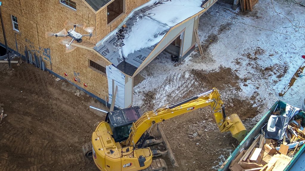
Let’s dive into the world of construction and mining, where drones are shaking things up like a summer earthquake. It’s not just about hard hats and shovels anymore – we’ve got drones doing the cha-cha on construction sites!
Imagine this: drones buzzing around, creating topographic maps that are more accurate than your Auntie’s baking measurements. They’re surveying job sites like a hawk eyeing its prey and keeping tabs on how our construction mates are flexing their muscles. And hey, they’re not just the wallflowers at the construction party; drones help set up site logistics. Picture this – executive planners using drone maps to showcase the project’s dance moves, predicting how contractors, gear, and materials will tango through each phase. It’s like a high-tech ballet, but with cranes and concrete.
According to PwC, the drone game in construction and mining is like finding a pot of gold at the end of the rainbow – potentially worth a cool $28.3 billion globally. These companies aren’t just playing around; they’re using drones to dance to the tune of compliance and strict safety regulations. Safety first, right?
Now, let’s talk mining – not the old-school pickaxe and shovel kind. Drones are the surveyors of the mines, whether they’re chilling in the open-pit or having an underground adventure. They’re mapping out these colossal sites faster than you can say “Gold Rush.”
But hold on, there’s a plot twist – the recent evolution of drone mapping in construction. Construction crews are ditching the geo-reference orthomosaics jargon (aka no ground control points) and diving into the world of 3D models. It’s like construction companies have upgraded to the VIP section, using these models to market potential projects, show off the glow-up over time, and visualize their project’s journey.
With these 3D models and snazzy VDC software, construction companies are practically playing Sims with their projects. They’re not just building; they’re creating life-like 3D models that would make even virtual architects raise an eyebrow.
So, here’s to the drones making construction and mining look like a blockbuster movie. Stay tuned, mate – we’re just scratching the surface of what these flying wizards can do! Cheers to building dreams!
Utility Inspections: Cell Tower and power mapping
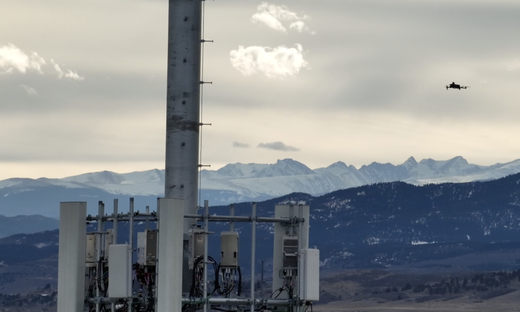
Utility Inspections, the unsung heroes keeping us all connected. Picture this: cell towers standing tall, doing their wireless dance, and cellular companies playing the upgrade game faster than you can say “sweet as.”
So, these cellular wizards are like the Avengers of the tech world, upgrading antennas, tossing out the old ones, and basically giving our wireless lives a glow-up. It’s like a high-stakes game of musical chairs, but with antennas.
Now, here’s the juicy bit – imagine a “Zillow-like” app for cell towers. Yeah, you heard it right. It’s like house hunting, but for antennas. Drones are getting in on the action, mapping out every tower and antenna in the country. It’s practically creating a tower treasure map, but instead of X marking the spot, it’s all about where your calls get the best reception.
With the power of drone mapping and modeling, these cellular maestros can pinpoint every tower, know which antennas are strutting their stuff in what spot, and figure out the coverage like a boss. It’s like having a backstage pass to the wireless concert.
And here’s where it gets even cooler – drone models spill the beans on the antenna’s angle. Yeah, the secret sauce that decides how much coverage you’re getting. It’s like knowing the perfect angle for that selfie – but instead of looking good, it’s about your calls not dropping like a hot potato.
So, next time your phone has you feeling like you’re in the middle of a bad breakup with your signal, just remember, somewhere out there, drones are doing their wireless tango, making sure those antennas are on point. Cheers to staying connected, mate!
Weather Forecasting with a drone
Let’s talk about something as Kiwi as fish and chips on the beach – weather forecasting. Drones are doing more than just photobombing our landscapes; they’re diving headfirst into storms, like your cousin at a summer pool party.
Imagine this: drones fearlessly waltzing into storms, not for a thrill but to snag crucial info. They’re the weather warriors, measuring the temperature, pressure, humidity, and wind speed – basically, they’re the cool kids at the weather data party.
Now, scientists are getting all fancy, using drones to collect research data. It’s like sending our trusty robot mates on a mission to unravel the mysteries of weather. They’re the James Bonds of meteorology, minus the tuxedos and martinis.
And here’s the punchline – with all this gathered intel, we’re not just impressing our friends with our weather knowledge; we’re talking advanced storm warnings. It’s like having a heads-up before the storm hits, giving us enough time to grab a cuppa, bunker down, or casually evacuate if needed. Safety first, right?
So, next time you’re caught in the rain without an umbrella, just remember, somewhere out there, drones are doing their weather dance, making sure we’re all clued in. Cheers to staying dry and outsmarting Mother Nature, mate!
Surveying drone service
Drone mapping swooping in like a superhero, giving us the lowdown on land faster than you can say “sweet as.”
Surveying the old-school way? Well, turns out, humans are prone to the odd oopsie. In Florida, a surveyor discovered that 1 in 3 surveys had a touch of human error. We’re only human, right? But here’s the kicker – there are places on this good green Earth that us ground dwellers just can’t reach. Enter drones, the eye in the sky.
Drone mapping is like surveying on steroids, but legal ones. It’s the shortcut to covering vast lands, even the tricky nooks and crannies that would make your GPS throw a tantrum. It’s like having a super-powered map that showcases everything – elevations, infrastructure, and property lines. No more playing hide and seek with property boundaries.
But here’s a friendly PSA to all you drone pilots out there – don’t go offering surveying services without the golden ticket, aka a surveying license. It’s like trying to DJ a party without ever touching a turntable – not a good idea.
So, next time you see a drone doing its mapping dance, just know it’s not spying on your veggie patch; it’s just helping us map the way to a hassle-free surveying life. Cheers to faster surveys and fewer “whoops, my bad” moments!
Real estate drone service
Not your usual snooze-fest, promise! So, imagine this: drones doing the real estate tango, creating maps and 3D models that make your regular property listing look like a relic from the past.
We’re not just talking about your run-of-the-mill backyard; we’re talking large estates, commercial gems – the whole shebang. Drones are like the Gandalfs of real estate, showing us the way with their high-tech wizardry.
Now, usually, you’d think drones are reserved for the big shots – luxury ranches, fancy Airbnb spots, those sprawling campgrounds that could host a mini-festival, and the creme de la creme – waterfront properties that make you question your life choices.
It’s like having your own personal real estate tour from the comfort of your couch. No need to put on pants, mate! Drones are taking real estate listings to a whole new level, making even the fanciest mansions jealous.
So, next time you’re dreaming of that dream home, just remember, somewhere out there, drones are doing the property catwalk, making every listing look like a star.
Environmental Monitoring and Protecting Wildlife with a drone
Drones aren’t just buzzing around for a good view; they’re like our eco-warriors, keeping an eye on Mother Nature’s mood swings.
So, picture this: drones doing the tango with the environment, mapping out changes like your nosy neighbor keeping tabs on your garden. They’re the Sherlock Holmes of land use changes, forest health, and coastal erosion. Basically, they’re our real-time Earth guardians.
But here’s the kicker – drones aren’t just about maps; they’re like superheroes in disaster zones. They swoop in, map out the chaos, spot critical infrastructure, and become the wingman for rescue and recovery efforts. It’s like having a high-tech sidekick for Mother Nature’s wild moments.
Now, let’s talk wildlife protection, because who doesn’t love a good critter tale? Conservationists are using drones like undercover agents, equipped with night vision and thermal sensors. It’s like having a secret agent in the animal kingdom, patrolling parks, and giving poachers a run for their money. Take Liwonde National Park in Malawi, for instance – they’ve got anti-poaching drones doing the night shift, sniffing out illegal snares, keeping an eye on the park party, and helping law enforcement play hide and seek with poachers.
And guess what? These are just a snippet of the drone magic happening in the environmental realm. As drone tech does its evolution dance, we’re bound to see more tricks up its sleeve. It’s like the tech world’s version of “what’s next?”
So, here’s to drones keeping Mother Nature’s secrets safe and sound. Cheers to the ever-evolving dance of drone mapping – where innovation meets the great outdoors!
Emerging Drone Mapping Verticals
Where business ventures are taking a stroll into the mapping scene like it’s the hottest café in town. It’s not just about maps; it’s about making decisions with data so detailed, it’s practically spilled the tea for you.
Imagine this: Landscape Architecture, HOAs, Metro Districts, Parks and Recreational Departments – they’re all donning their mapping hats. Even Event Planning and Emergency Management are jumping on the drone wagon. It’s like the cool kids’ club of decision-making, and drones are the VIP ticket.
Need to spruce up your backyard? Landscape Architecture has got you covered, making sure every tree and shrub is in its happy place. HOAs and Metro Districts are like the neighborhood watch on steroids, keeping tabs on everything from the sky. Parks and Recreational Departments are using drones for maintenance – because mowing the lawn is so last season.
And don’t get me started on Event Planning; they’re droning on about creating the perfect bash from the sky. Emergency Management is like Batman with a drone cape, swooping in to save the day. Zoning, Civil Engineering, and Community Planning – they’ve all joined the drone party.
So, buckle up, mate! In the next chapter, we’re spilling the beans on the hottest drone mapping software and platforms. It’s like a tech fashion show, and you’re front-row VIP.
Types of Drone Mapping Software
It’s like choosing the perfect fish and chips shop, but way geekier. We’ve got three contenders in the ring:
- Photogrammetry Software
- LiDAR Mapping Software
- 3D Modeling Software.
Photogrammetry Software
Photogrammetry Software is the artist of the bunch, using drone-snapped pics to craft 2D and 3D masterpieces. It’s like your drone’s personal Picasso, creating realistic landscapes and topographic wonders. Think of it as your go-to for everything from agriculture to construction – it’s the jack of all trades.
LiDAR Mapping Software
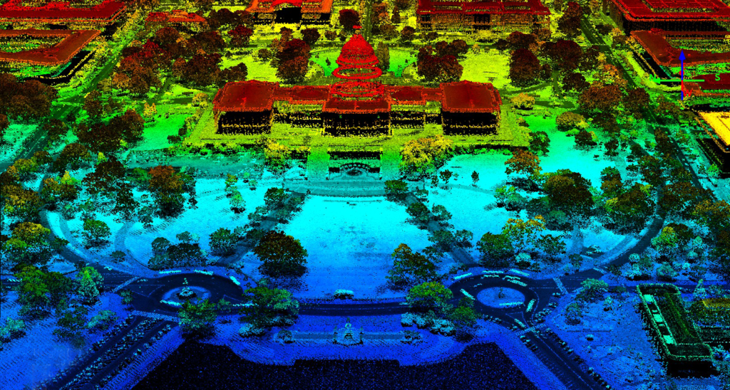
Now, enter LiDAR Mapping Software, the laser-wielding superhero of the mapping world. It’s like having a tiny laser show in the sky, collecting 3D data for the big leagues – large-scale mapping and engineering. Precision is its middle name, providing data so crisp, you’ll want to frame it.
3D Modeling Software
Last but not least, the 3D Modeling Software – the Hollywood director of the drone world. It turns collected data into 3D masterpieces, from architecture wonders to marketing marvels. Picture it as your drone’s Spielberg moment, minus the Hollywood budget.
Now, here’s the real talk – the best life-like 3D modeling software is like the VIP section of a concert. We’ve got Capture Reality, Bentley (or the Bentley-engine-powered Optelos), and Pix4D (although it’s the rockstar with the lowest quality – we all have our off days).
So, there you have it, mate! Choosing the right drone mapping software is like picking the perfect Kiwi pie – it depends on your cravings. Stay tuned for more tech talk, and remember, drones are the artists of the future! Cheers to mapping magic!
How To Pick The Right Drone Mapping Software?
First up, we’ve got Acquisition Software – the smooth operator of the trio. It’s all about capturing those epic drone shots that make your mapping dreams come true. Think of it as the photographer on a mission to capture the perfect moment.
Next in line is Processing Software – the behind-the-scenes maestro. This one takes all those raw drone shots and transforms them into mapping gold. It’s like the magic wand that turns pixels into masterpieces. Who knew processing could be so enchanting?
Last but not least, Cloud-based or All-in-one Software – the all-inclusive holiday package of mapping. It’s like the one-stop-shop for all your mapping needs. No need to juggle between different tools – this one’s got it all under one digital roof.
Now, let’s break it down over a cuppa. Acquisition gets you the shots, Processing turns them into gold, and Cloud-based or All-in-one keeps it all neat and tidy. It’s like a mapping party, and these software categories are the VIP guests.
Choosing the right software is like finding the perfect fish and chips spot – it’s got to hit the spot. So, there you have it, mate! Your quick guide to the drone mapping software showdown.
Acquisition Software
Acquisition Software. It’s the secret sauce that helps us plan those epic drone missions, capturing shots that are more ‘wow’ than a sheep jumping over a fence.
So, what’s the deal with this Acquisition Mapping Software? Picture this: it’s like having a personal drone maestro, telling your bird in the sky to dance to a highly-overlapping beat. These flight paths are so on point, they make your GPS look like it’s still stuck in 2005.
Now, for the software squad:
- DJI Pilot 2 – the go-to for all our DJI Enterprise Drones. It’s like the DJ spinning the tracks at the drone party, making sure everyone’s grooving.
- Maps Made Easy – the web application that’s as easy as pie. Just a few clicks, and your drone is off on a mission, snapping pics like a seasoned paparazzo.
- Pix4D Capture – the computer whiz of the bunch. Install it on your computer, and suddenly, your drone is mapping like it just graduated from mapping school with top honors.
- UCGS – the desktop-based stitching maestro. It takes those images and videos and stitches them together like a pro, creating a masterpiece that’s ready for the spotlight.
Processing Software
The wizard behind the mapping curtain. It’s like the tech-savvy friend who turns your drone pics into a mesmerizing point cloud, unlocking a realm of mapping possibilities.
So, what’s the deal with this Processing Software? Picture it as your data’s personal magician, conjuring up a point cloud that’s more magical than finding a Kiwi bird in the wild.
Now, for the lowdown on the software:
- Pix4d Mapper – the go-to for pilots who want to customize their data like they’re choosing toppings on a pizza. It’s the DIY of drone processing, giving you the reins to craft your mapping masterpiece.
- Bentley – the maestro in the symphony of mapping. It’s like having a conductor that orchestrates your data into a harmonious point cloud, ready for its mapping debut.
- Metashape – the cool cat in the processing gang. It’s all about transforming your data into sleek deliverables, like turning a plain old photo into a vibrant meme.
This software gang usually hangs out on your trusty desktop PC or laptop, flexing their muscles on any Windows-based computer. They stitch together data points like a knitting circle on turbo, birthing a point cloud that can morph into Digital Surface Models, 3D textured meshes, or even a digital terrain model.
With these processing skills, drone pilots become the data maestros. Fixing data hiccups is as easy as a sheepdog herding sheep. So, there you have it, mates! Processing Software – turning your drone data into a mapping symphony.
All-in-One Cloud-based Software
The cool kid in the mapping block, like the DJ spinning the beats at a Kiwi barbecue.
So, what’s this fuss about Cloud-based wonders like DroneDeploy? Well, it’s like having your own mapping genie. You snap some pics with your drone, toss them into the cloud, and voilà – it processes the data while you kick back with a cold one. Easy as catching a wave at Piha.
But, fair warning, mate – DroneDeploy ain’t your one-size-fits-all superhero. It loves stable cell signals, but throw it into a complex 3D maze, and it might get a bit lost, like trying to find your way in a dark kiwi forest.
And here’s the cheeky truth – if you’re a data control freak, DroneDeploy might not be your cuppa tea. It’s like asking a sheepdog to let the sheep do the herding – not happening.
Comparison of Different Types of Drone Mapping Software Available in the Market
Picture it like choosing your favorite fish and chips joint – accuracy, ease of use, cost, and how well it jives with your drone are the secret herbs and spices.
Pix4DMapper
The software that turns your drone escapades into a smorgasbord of goodies. It’s like having a menu of options for your data feast.
Pix4DMapper is your go-to mate if you want the whole buffet of deliverables – orthomosaics, point clouds, DSMs, DTMs, topographic maps, 3D textured mesh, video animations – you name it! It’s the culinary genius of drone data.
With Pix4D Mapper, you’re the master chef of your data kitchen. Want a marketing video? Easy peasy. Planning a construction bash? Pix4DMapper’s got your back. Fancy crafting 3D textured mesh models? Consider it done, mate!
In a nutshell, Pix4DMapper is the wizard of desktop processing, giving you the best bang for your buck and the freedom to whip up a diverse range of data delights.
Pix 4D React
The speed demon of orthomosaics. It’s like the Usain Bolt of creating those critical drone deliverables.
Orthomosaics are the rockstars in the drone realm – vital for disasters, keeping the public safe, and the whole construction and engineering shebang. Pix4D React takes the crown as the Flash of orthomosaic generators, especially when your internet decides to play hide-and-seek.
Now, here’s the lowdown – Pix4D React won’t let you play the actual geo-referencing game with your orthomosaic. But, fear not, my Wingtra drone buddies! If you’re rocking the fixed-wing marvel, pre-georeference those pics, then let Pix4D React do its magic – quick, scalable, and geo-referenced.
Oh, and a sneaky tip for you – if you’re dancing with a Wingtra drone and want the speediest geo-referenced orthomosaic, Pix4D React is your dance partner.
But, hey, if the internet gods are on your side, toss those drone pics onto the cloud with DroneDeploy – the cloud maestro of orthomosaic speed, even if it skips the geo-referencing party.
Pro Tips time:
- Wingtra + Pix4D React = Fastest Geo-Referenced Orthomosaic. Bingo!
- Search-and-rescue heroes swear by React for a quick check of their photo collection – no internet? No worries.
- Construction pals are ditching dollars on Pix4D React for lightning-fast “Rapid Orthos” right after the flight. Speedy Gonzales would be proud. Cheers to soaring high without breaking the bank!
DroneDeploy
Hey there, fellow dronies! Let’s chat about DroneDeploy, the cloud wizard of mapping. Picture this: uploading drone pics and conjuring an orthomosaic without all that geo-referencing fuss. It’s like magic, but with more propellers.
Now, DroneDeploy is the go-to guru for stellar volumetric measurements. Need to size up a plot? It’s got you covered. But, hold your drones – it’s not all sunshine and rainbows. Let’s dig into the quirks:
- Complex 3D models? Nah, not DroneDeploy’s jam. It’s like trying to teach a drone to breakdance – cool, but not happening.
- Mixing data from different flights? Nope, not in DroneDeploy’s rulebook. It’s a bit like having two DJs at a party, but they can’t sync their beats.
- MTP construction or aligning data? Sorry, not in this cloud’s playbook. It’s a bit like trying to build a Lego castle without instructions – tricky.
- High-level organization? Nah, DroneDeploy keeps it casual. Your data’s on a bit of a solo adventure – no ownership vibes here.
- Volumetric measurements playing with the digital surface model? Yep, that’s DroneDeploy’s game. It’s like measuring a cake without knowing the recipe – you get the idea.
Now, let’s talk accuracy – or the lack of it. DroneDeploy’s like trying to measure a wall from across the room. Precision? Not their strong suit. Imagine squinting at a tape measure from 20 feet – not the best strategy, right?
But hey, don’t pack up your drones just yet. For beginners and folks eyeing volumetric missions, DroneDeploy’s still a solid wingman. It might have quirks, but hey, who doesn’t?
Reality Capture vs Context Capture
The heavyweight champs of 3D modeling. In our humble Kiwi opinion, Reality Capture takes the crown, but hold on to your propellers; there’s a bit of quirkiness to it.
Reality Capture’s like the cool kid at the party – the best, but maybe a tad clunky. The user interface is a bit like finding your way through a hedge maze blindfolded. Fun, right?
Now, enter Context Capture by Bentley. It’s the superhero of 3D model generators, but here’s the plot twist – it’s got an expensive cape. Cue Optelos, our budget-friendly sidekick that harnesses the Context Capture magic without breaking the bank.
Optelos lets us ride the 3D modeling rollercoaster of Context Capture for a price that won’t make your wallet scream for mercy. Half or even a third of the usual Bentley bill – talk about a sweet deal.
Pro Tip:
Sometimes, I play matchmaker between Reality Capture and Pix4D Mapper. It’s like taking the best bits of two mates to create the ultimate 3D model – because who doesn’t love a bit of tech matchmaking, eh?
Optelos
From regular old mapping to the big leagues of macro-level data wizardry. And guess who’s leading this rad parade? Drumroll, please… Optelos!
These legends are all about gathering up 360 images, sky-high 360 Panos, and interior 3D models, throwing them into a data blender, and voila – a single point cloud or a 2D map that’s like the superhero of data integration.
Now, in the realm of executive-level mapping management, Optelos takes the cake. Trust me, it’s like the VIP lounge of mapping software.
But wait, there’s more! Optelos brings something extra to the table – the “ortho compare feature.” Sounds fancy, huh? Well, it’s a game-changer, especially in construction where orthomosaics rule the roost.
Imagine stacking up multiple orthomosaics like a high-tech Jenga tower. With the swipe of a finger, you time-travel through these snapshots, unveiling the evolution of a construction site. It’s like flipping through a visual diary of your project’s journey, week by week.
This nifty ortho-compare gig isn’t just eye candy; it’s a Sherlock Holmes tool for spotting issues before they become construction site drama. Optelos, you beauty!
Propeller Aero
The cool cats in the drone mapping game.
Now, these guys bring something to the table called Arrow Points. It’s like your GPS for data, making geo-referencing a breeze. But here’s the real star of the show – their processing software is the MVP for “cut and fill” calculations. What’s that, you ask?
Picture this: You’re on a construction site, moving dirt around like a landscaping maestro. Propeller Aero’s software not only tracks how much soil you shifted but also clocks the time it took. It’s like having a digital stopwatch for your earth-moving antics.
Why does it matter? Well, it’s your backstage pass to efficiency central. You can tell if the job was a well-oiled machine or if you ended up playing musical dirt, shifting it where you shouldn’t. And trust me, avoiding dirt-related dramas down the line is the name of the game.
Here’s a little nugget of wisdom – Propeller’s processing magic shines brightest in quarries and those big-shot construction gigs. Their efficiency analysis is like a superhero cape for contractors, giving them the power to measure earthworks efficiency better than anyone else. Think cut-and-fill measurements over time – it’s like tracking the epic saga of dirt relocation.
Best Drone Mapping Software: Our Top Picks
Let’s dive into the magical world of mapping software, where choices abound like sheep in the Kiwi countryside. It’s a bit like trying to pick the best fish ‘n’ chips joint – everyone has their own secret sauce.
But fret not, mates! I’ve wrangled up a bunch of top picks to make your life easier than finding a hobbit in Middle Earth. Check it out:
- Cost-effective Mapping Software: Pix 4D Mapper – the budget-friendly hero.
- Orthomosaic Mapping Software (Without Internet): Pix 4D React – for when your internet’s on a coffee break.
- Orthomosaic Mapping Software (With Internet): DroneDeploy – because we all need the cloud sometimes.
- Volumetric Measurement Software: DroneDeploy – measuring volumes like a digital Hercules.
- 3D Mapping Software (Affordable): Optelos – making 3D magic without breaking the bank.
- 3D Modeling Construction (Advance Features): Capture Reality – for the big leagues of 3D wizardry.
- Best Drone Software for Construction: Optelos/Propeller Aero – the dynamic duo of construction mapping.
Pro Tip time! Pix4D Mapper lets you turn “crap” data into gold – beat that, cloud-based folks! Reporting might be a bit meh, but fear not, we’ve got a Mapping Bootcamp to the rescue.
Between Optelos and Propeller Aero, my money’s on Optelos. It’s like Marie Kondo for your assets – tidy and organized. DroneDeploy’s hanging in there too, especially with its new buddy, StructionSite. But for a cost-effective dance with quality, Kuula is your partner in crime.
Choosing the best drone mapping software is like picking your go-to fish ‘n’ chips – it depends on what you’re craving. So, think about the deliverable you want and how you’ll interpret the data. Now, strap in for a ride as we explore the best drones to help you map your way through the tech wilderness.
Best Drones For Mapping
Now that we’ve had our chinwag about mapping software, let’s tackle the real stars of the show – the drones! It’s like picking the perfect sheep from the flock, but way cooler.
So, in the left corner, we’ve got the DJI Mavic 3 Enterprise, ready to take on the veteran Phantom 4 Pro. These are the big guns, the MVPs of the mapping game.
DJI Mavic 3 vs Phantom 4 Pro
The Phantom 4 Pro is like that classic kiwi dish – it’s been around, and it’s a bit of a legend. Shooting 4K videos and RAW photos, it’s like the All Blacks of the drone world. And guess what? It’s more budget-friendly than splurging on a night out in Auckland.
Now, entering the ring with a swanky new vibe is the Mavic 3 Enterprise – the trendsetter of the DJI family. But, there’s a catch. It’s not as snazzy in the video quality department as its Mavic siblings. They’re like the flashy cousins with 4K video and RAW photo swagger.
DJI seems to be nudging us towards the Mavic 3 Enterprise for autonomous missions, throwing in unique features like a chef tossing ingredients into a potluck. But here’s the kicker – you’ll need to drop triple the cash compared to the Phantom 4 Pro to get all the bells and whistles.
It’s a bit like deciding whether to buy three pies or one really fancy steak and cheese. DJI, if you’re listening, wouldn’t it be sweet as to sprinkle those features across the whole Mavic lineup? More choices, more fun!
So, there you have it – the Phantom 4 Pro still holds its value like a classic Kiwi bach. Now, let’s hope DJI serves up a smorgasbord of features for all us drone aficionados.
Which Mapping Drone Should You Buy?
Now, the Mavic 3 Enterprise is like the reliable mate who always shows up at the pub. Solid choice, but it plays well mainly with DJI Pilot 2 and a couple of other apps – a bit like having a favorite drinking buddy.
But hold on, if you’re all about capturing epic videos, acing mapping missions, and snapping raw photos that would make even a kiwi bird jealous, then roll out the red carpet for the Phantom 4 Pro drone. It’s the rockstar of mapping drones – the Ed Sheeran, if you will.
If the Phantom 4 Pro is playing hide and seek, no worries. The Mavic 3 Enterprise can step up to the plate, too. It’s like having a solid backup plan when your favorite fish and chips joint is closed.
Best Non-Chinese Drone For 3D Mapping: Parrot Anafi Ai
Now, if you’re on the lookout for a mapping drone that’s steering clear of the Great Wall or DJI’s realm, let me introduce you to the Parrot Anafi Ai – the Kiwi choice for mapping adventures.
This bird, the Parrot Anafi Ai, not only flies high but comes equipped with Pix4D Capture acquisition software right out of the box. It’s like having your favorite dipping sauce included with your fish and chips – no extra charge!
And here’s the kicker – it’s NDA approved for soaring through American skies. Yep, Uncle Sam gave it the nod, making it the go-to option for those who want their drone to have a star-spangled seal of approval in the airspace.
Techniques for Effective Drone Mapping
Here’s your ticket to mapping glory with a sprinkle of Kiwi wisdom.
Proper Planning:
Picture this like planning a barbie – size matters! Before sending your drone on a mapping mission, figure out the area’s size, pick the right drone (no, not the one from your neighbor’s shed), and gear up for the data quest. Don’t forget to check the weather – droning in the rain isn’t as fun as it sounds.
Camera Settings:
It’s not just about saying cheese! The magic lies in nailing those camera settings. Get cozy with resolutions, image formats, and camera angles. It’s like finding the perfect filter for your Instagram pics – only way cooler.
Flight Planning:
Imagine your drone is the All Blacks, and the sky is its rugby field. Precision is key. Plan your flight altitude, overlap, and path like a coach strategizing the winning game. Consider the drone’s software demands – it’s your playbook for a mapping touchdown.
Data Processing:
This is where the digital magic happens. Photogrammetry and LiDAR software are your wizards. Choose the right spells (algorithms), tweak those settings, and voila – you’re turning drone pics into mapping gold. It’s like mixing ingredients for the perfect pavlova – a Kiwi classic.
Quality Control:
No one likes a wonky map. Run those quality checks like a hawk eyeing its prey. Ensure your images are top-notch, your map is accurate, and any glitches get the boot. It’s like proofreading an epic novel – you want it flawless.
The Future of Drone Mapping
Allied Market Research predicts that by 2027, the construction drone market is set to soar to a whopping $11.96 billion. Now, let’s throw our gaze on the trends painting the skies of the drone mapping industry.
Greater Accessibility:
Picture this – drone mapping tech becoming as accessible as your morning coffee. Lower costs, user-friendly software, and portable drones are making it easier for everyone to join the mapping party. It’s like the democratization of the skies, giving wings to the masses.
Integration with Other Tech:
Drones are cozying up with the tech elite – artificial intelligence, machine learning, and the Internet of Things. Imagine your drone becoming the James Bond of the tech world, doing real-time monitoring, predictive analytics, and even flying autonomously. The future is all about the drones joining the ultimate tech Avengers.
Increased Regulation:
With great drones come great responsibility, right? As drone usage skyrockets, authorities are tightening the reins, especially on data privacy. Keep your ear to the ground for the latest rules – it’s like staying in tune with the coolest drone symphony.
New Applications:
Brace yourselves for a wave of innovation! From environmental monitoring to construction planning, and even autonomous flight – the drone revolution is just getting started. It’s like exploring new galaxies, only with drones and not spaceships.
Emergency Response Upgrade:
Drones to the rescue! Improved drone cameras mean quicker identification of victims during emergencies. Efficient surveys post-natural disasters guide relief efforts precisely. Drones are the superheroes in the emergency response league, swooping in to save the day.
Construction Marvels:
Construction pros, rejoice! Drones armed with imaging tech are your new best mates. Imagine them as your construction sidekicks, swiftly covering vast areas, producing 3D magic, and providing vital project data. Safer buildings, on-time projects, and budget goals met – it’s like having a construction genie in the sky.
Conclusion
Well, mates, buckle up for the grand finale! Experts are throwing their crystal balls into the ring, predicting that the global surveying and mapping services market will be doing the cha-cha with a 3.4% compound annual growth rate, reaching a dazzling US$13 billion by the dance-off year 2032. If you fancy a deep dive into the crystal ball gazing, check out the full report [here](insert link).
Now, let’s talk about the future of drone mapping. Hold on to your hats because this ride is about to get even wilder. Picture this: drones swooping into various industries, shaking things up like a drone-powered earthquake. From construction sites to emergency responses, they’re like the Avengers of the tech world – versatile, efficient, and ready to save the day.
But hey, don’t just stand there nodding. If you’ve got burning questions about drone mapping or need a bit of navigational advice in this high-tech terrain, drop your thoughts below. Let’s kick off a conversation that’s as lively as a drone’s flight path. Until then, keep your eyes on the skies and your drones soaring high!
The sky isn’t the limit.